 |

|
|
|
|

RoboGEO 4.1 [Homepage] - by: TimTech Computer - Download 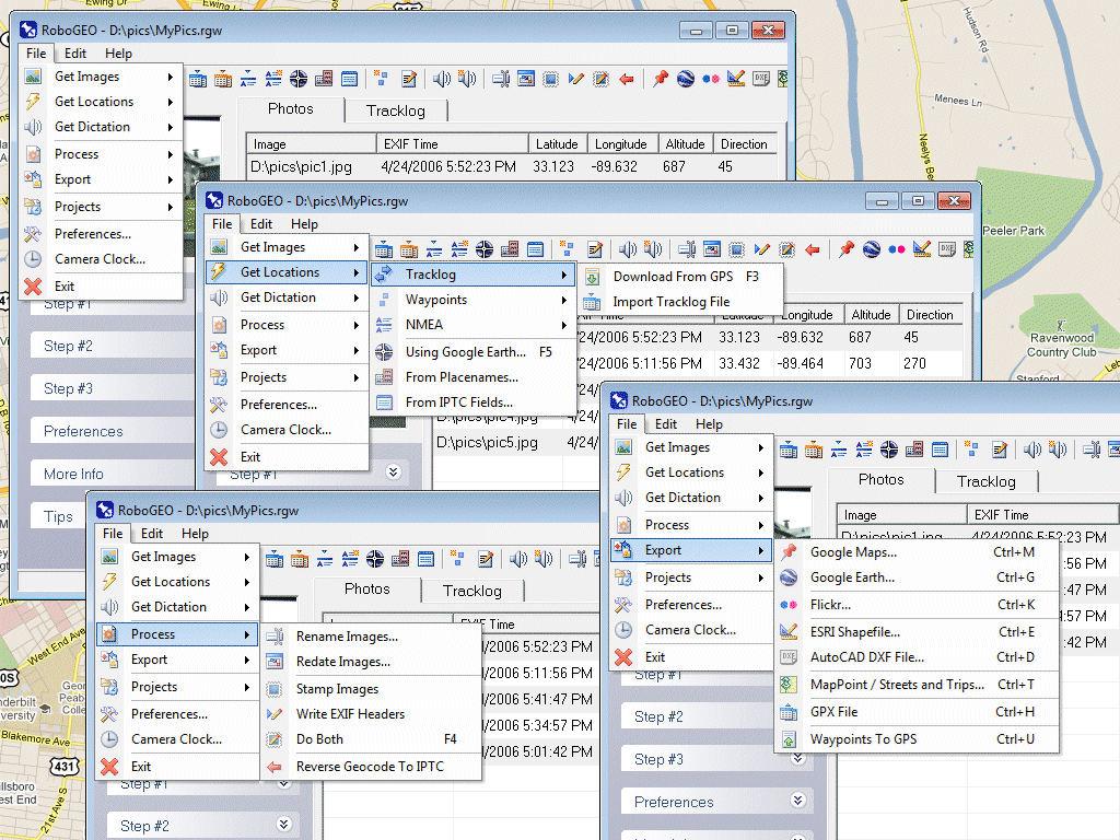 Click to enlarge Description: Geocode digital images with latitude, longitude, altitude, and photo direction information. RoboGEO stamps this information onto the actual photo or writes it to the EXIF headers, allowing you to permanently geotag and link your photos to the GPS coordinates. All writing to the EXIF and IPTC headers is lossless and all of the existing comments (including the MakerNote and the Adobe XMP metadata) are preserved. Now you can know WHERE a given photo was taken. Create web pages that use Google Maps, export KML or KMZ files to Google Earth, upload geotagged photos to Flickr, export ESRI SHP shapefiles, export to MapPoint, or export DXF files for use in various vector based drawing programs such as AutoCAD or IntelliCAD. Show the photo direction on maps and calculate it from the GPS tracklog. Automatically merge EXIF or IPTC tags into the image titles and descriptions. Record dictation using any modern digital voice recorder and automatically associate audio with the photos. Export GPX files. Edit the EXIF times. Photo locations can be projected to a new location in either ground or airplane mode. Free EXIF/IPTC viewer included. Geocode any type of JPG, PNG, BMP, TIF, or Adobe DNG file. Directly supports Garmin GPS units (USB or COM), but no GPS is required. Georeference images from a GPS tracklog or waypoints. Import GPX or G7ToWin files for interfacing with other GPS makes and models like Magellan, Lowrance or Trimble. Supports DNR Garmin. Includes an image renaming utility that renames images based on the EXIF data. Works with any modern digital camera. Internationally aware. Very easy to use. Nice user interface. Perfect tool for aerial photography, GIS professionals, land surveyors, engineers, insurance claim adjusters or anyone who needs to document the location of photos. Low cost. Free lifetime upgrades. Extensive on-line documentation. Recent changes in this Major Update:
Comments (Add comment) | File size: 6451 Kb Date: 06/22/2006 Homepage Install support: Install and Uninstall OS: Win98, WinME, WinXP, WinNT 3.x, WinNT 4.x, Windows2000, Windows2003 System requirements: Windows 98/NT/ME/XP/2000/XP/2003/Vista Language: English |
See also in Graphic Painting and Drawing: Image Editing
|


 Free Download: